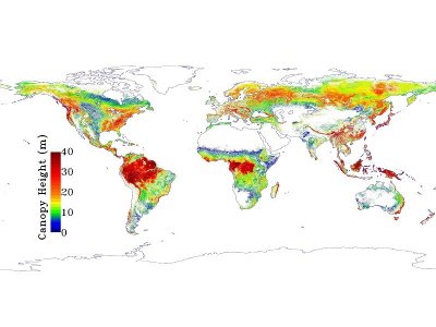
NASA led a project that allowed the creation of a high-resolution map of the Earth’s forests and their height using data from the ICESat satellite combined with data from other space missions and the WorldClim database.
This website uses cookies to add functionalities. Some are third-party and some are for targeting. If you're not OK with it you can use programs that block them or get our of this site.AcceptRejectRead More