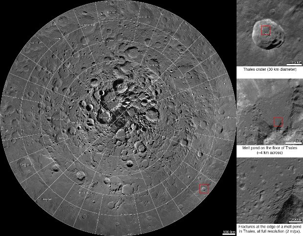
An interactive map of the Moon’s North Pole
Using the cameras of the Lunar Reconnaissance Orbiter (LRO) space probe, NASA scientists have created a very high resolution map, two-meters (six-and-a-half feet) per pixel, of the region around the Moon’s North Pole. This isn’t a simple but very detailed image, it’s an interactive map like Google Earth.